
Subdivision

Being a Licensed Cadastral Surveyor specializing in Land Transfer surveys, we can assist you with your next subdivision ensuring that the process from beginning to end is as smooth as possible. Giving you piece of mind your project is in the right hands.
Be it Fee Simple Subdivision, Unit Titles, Strata, Cross lease conversions we can take care of it all.
We can take your project from resource consent plans all the way through to the release of titles.
Call or email us today to discuss your project requirements.
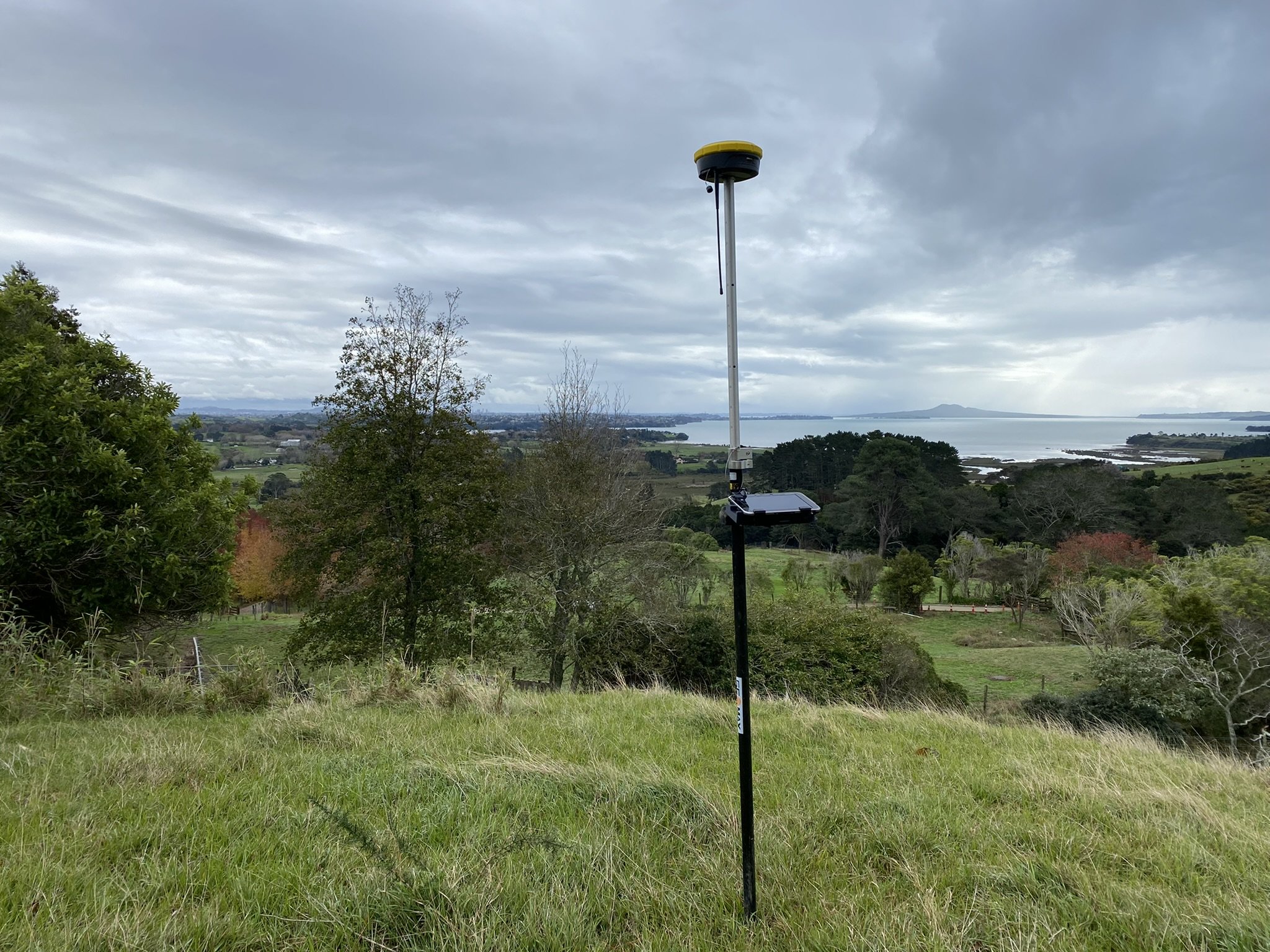
Topographical Surveys

A crucial part to complete before any work takes place. A topographical survey takes a three dimensional “snap shot” of a subject site. Locating important site features, services and levels with high accuracy to provide you with the best possible base to start the design work from.
A topographical survey generally works in terms of the property boundaries and an official datum to give your consultants and designers the best possible start to ensure that the project gets off on the right foot.
We provide a deliverable in PDF and DWG outputs.
Building Setout Surveys

We are Building setout specialists. We provide a high quality building setout for your contractors to work from ensuring your buildings are constructed in the right location and in terms of the design plans within a very tight tolerance.
As Auckland densifies and as buildings get closer to the boundaries it is critical that these buildings are surveyed to ensure they are constructed in the correct locations to avoid the project coming to a stand still before its out of the ground.
We can provide all council certification signed off by a Licensed Cadastral Surveyor. These are requirements by council for setout, siting and height to boundary certification.
Cross Lease Conversions & Flats Plans updates

We can assist with rectifying defective flats plans or converting existing cross lease titles to fee simple.
These processes require a Resource consent and lodgment of a survey plan by a Licensed Cadastral Surveyor. We can see this process through from start to finish.
Get in touch today and see how we can assist in making this process as simple as possible.
Boundary Surveys
A boundary redefinition survey is to place legal boundary pegs in the ground to establish your property boundaries.
This is often required when working in close proximity to the boundaries, for fencing purposes or to allow property owners to understand the extent of their property.
This requires that a survey plan be lodged with Land Information New Zealand (LINZ).
Height to Boundary Surveys

A height to boundary survey is to survey the constructed building to check that it has been built in accordance with an approved building or resource consent and within the unitary plan requirements for Height in relation to boundary.
We can provide certification from a Licensed Cadastral Surveyor.
Surveyor and Siting Certificates

Surveyors Certificates are to certify that the construction works have been setout by a qualified surveyor and are in accordance with the design plans.
Siting Certificates are to certify the construction works have been built in accordance with the design plans.
We can provide all appropriate certification from a Licensed Cadastral Surveyor.
As-built Surveys

Certified public drainage as-builts are required when new public infrastructure is installed. These are often part of new developments where an extension of the existing stormwater, wastewater and water networks are completed to allow for connection for all new lots. We can provide assistance is completing the as-built survey, preparation of the plans and certifying ready for submission with council.